I did my first multi-day tour with SMG almost 7 years ago, which was Sawtooth’s traverse. Since then, I have done most of them (Palisades, Rock Creek to Mammoth, Ritter), except for the Bishop Skyline tour. This particular tour has been on my list for a very long time, but even attempting it requires exceptional fitness and a really good snow year.
The latter was true this year with record-breaking snowfall in the Eastern Sierras, and regarding the former, I currently feel like I am in the best shape of my life. This was also going to be a porter-supported tour since it would be almost impossible for us to do it by ourselves while carrying everything for six days. The logistics were complicated, but it gave us the best chance of successfully completing it.
Given the nature of the tour and how intense it sounded, I did have some anxiety and apprehensions about being able to pull it off, but my supporter in chief, my awesome wife, calmed my nerves a lot. She told me that the worst that could happen is that we ski something smaller, change plans, or take a rest day. It’s not the end of the world, and the most important thing is that I give it my best when we get out there.
During the tour, I discovered that it was the first time anyone had attempted this tour since SMG first offered it. Someone came close to trying it in 2011, but it didn’t happen. Howie was going to warn me about this tour, but then he was like, “Nayan knows what he is getting into,” so he just went along with it since I really wanted to attempt it.
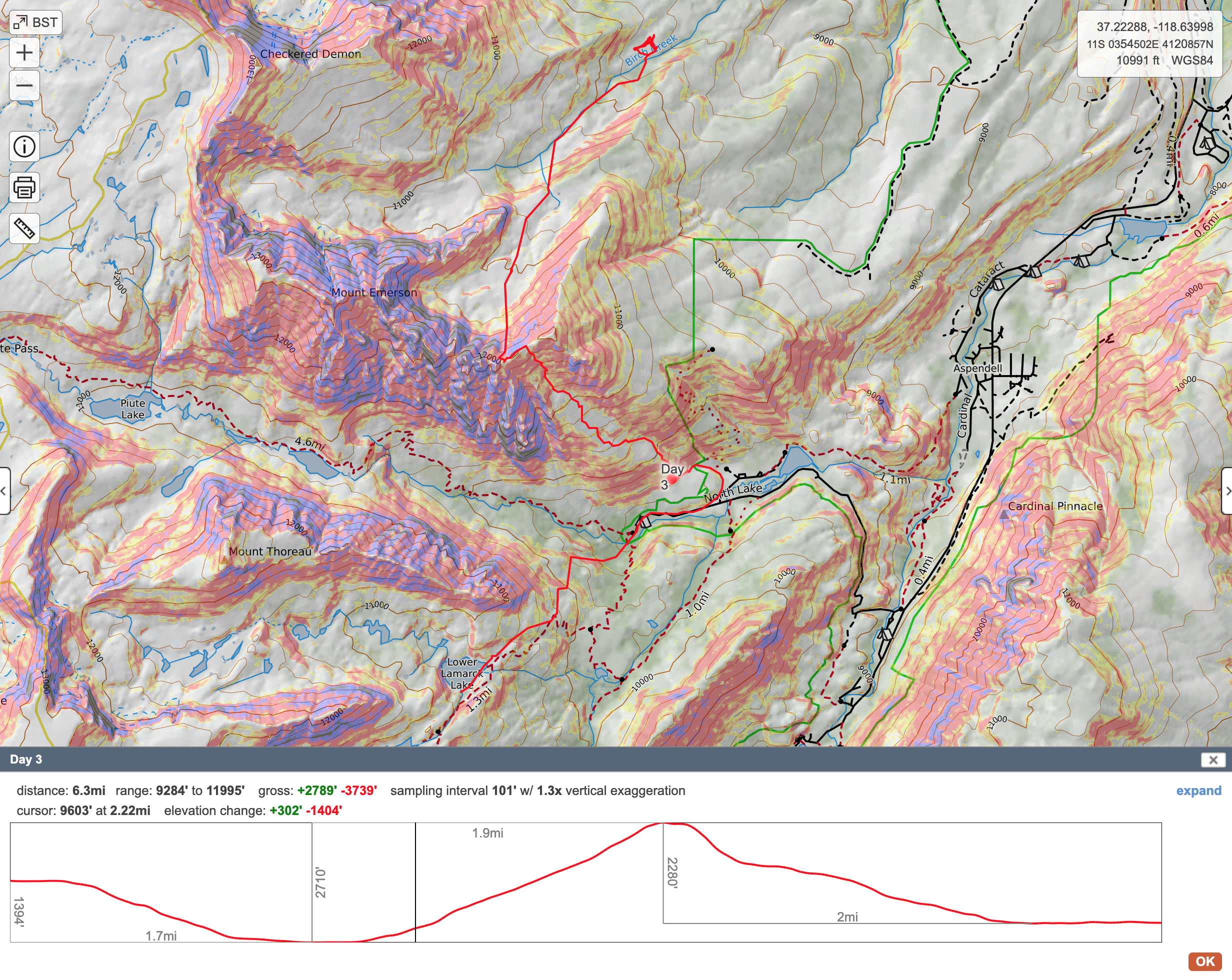
After going back and forth with Howie (Owner of SMG and mastermind behind the tour) regarding the dates, we settled on April 27th to May 4th as the 8-day window for the tour. I decided to stay in Mammoth a few days prior to get a head start on acclimatization, and I went touring around the lakes basin to sort out my gear and mainly my feet. I needed to tape most of my feet with leukotape for blister prevention.
We were going to start on the 28th and going to meet Howie in Bishop on 27th evening for a gear check and head out early morning. Our original Itinerary was as follows.
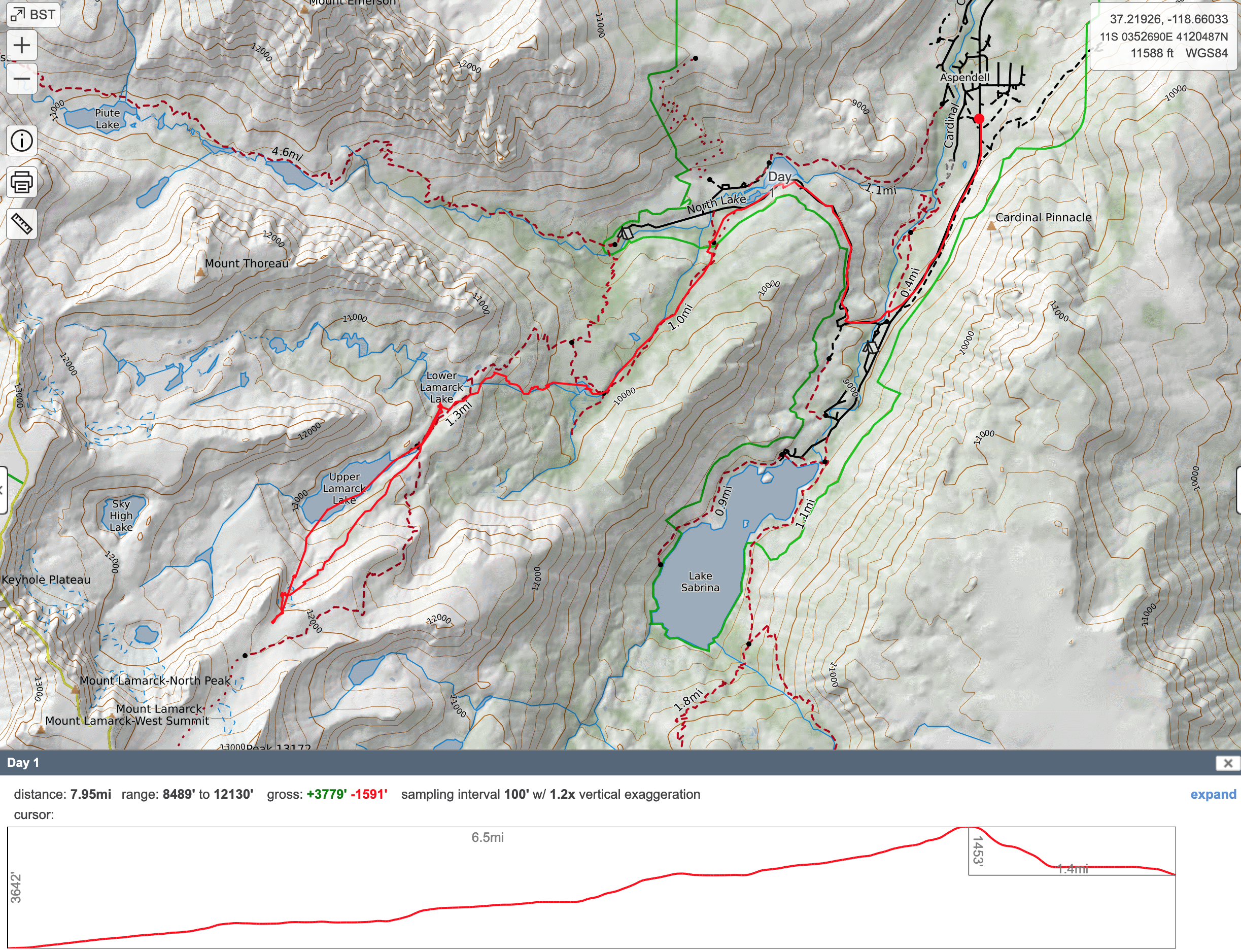
Day 1 – Carry in to basecamp at Lower Lamarck Lake. Light warmup ski tour from camp.
Day 2 – Mts. Darwin and Lamarck – overnight porter meets us at camp
Day 3 – Up Wonder Lakes, over “Fool’s Ridge” to Loch Leven and up and over Mt. Emerson. Porter takes gear/supplies around to Camp 2.
Day 4 – Day trip Mt. Locke and/or Mt. Humphrey’s.
Day 5 – Up and over Basin Mtn. to Horton Creek Camp 3
Day 6 – Day porter up to camp to pick up overnight gear. Over Mt. Tom to finish at Lower Horton Creek or Elderberry Canyon or Pine Creek. Shuttle on call to pick us up.
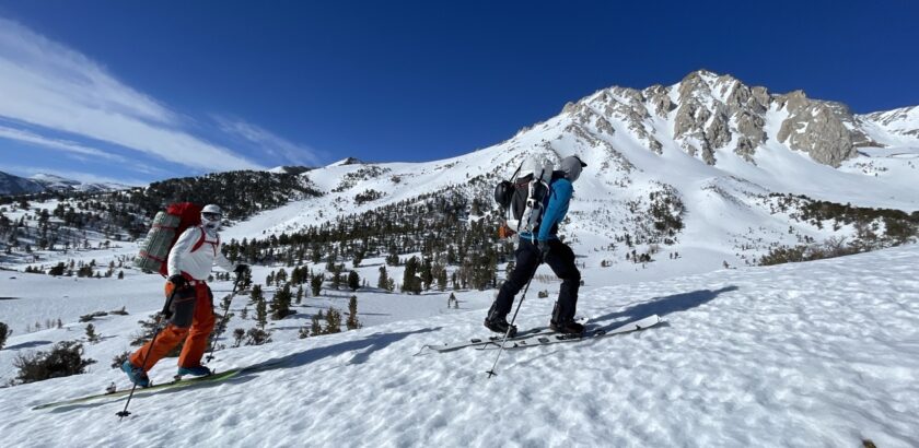
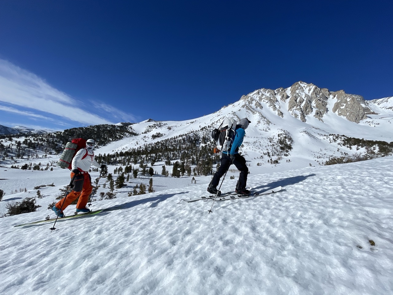
After a night in Bishop, we met early in the morning at the SMG office and drove to Aspendell. The road wasn’t plowed all the way to the North Lake trailhead, so we had to start skinning a little bit earlier. Slowly, we made our way to Lower Lamarack Lake. It was fairly easy going to Grass Lake, where we were able to fill up our water bottles, which was nice. Even though we had enough fuel to melt water, it was nice to get some freshwater and drink as much as we could.
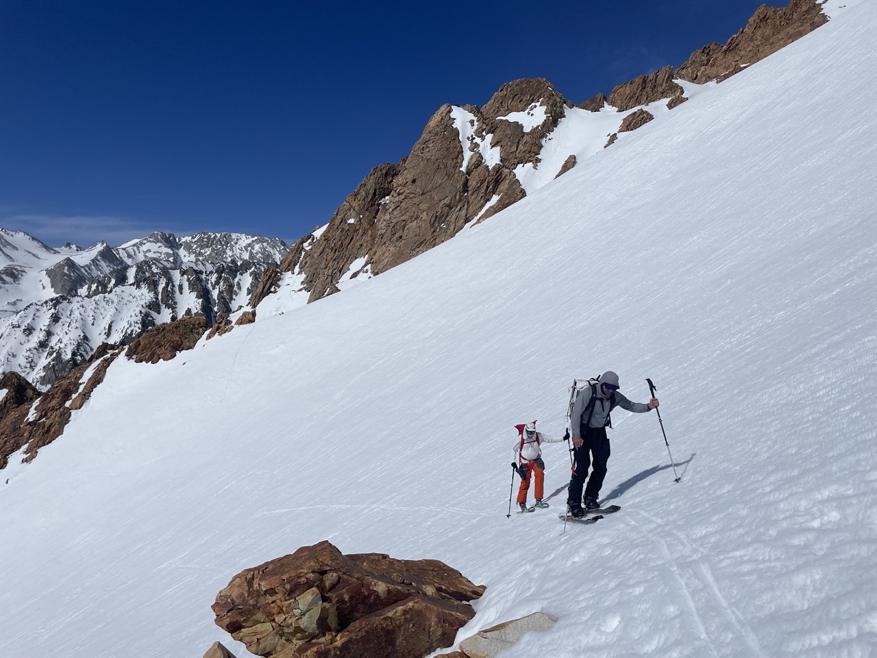
We made good progress and were able to find a nice campsite at Lower Lamarck Lake around noon. After getting settled, we decided to go for a tour towards Lamarck Col. We didn’t plan to go all the way to the col but were able to put in a bootpack for the next day on a steep slope. It was also a chance for Howie to evaluate our skiing; it has been a few years since I have skied with him, and this tour was his first time with Shawn.
On this tour, Howie packed a helmet (I have never seen him with one in the Backcountry before), which meant that things could get really spicy, and we had to be on our A-game at all times. I am still not 100% comfortable with hop turns in steep terrain (45-degree+ slopes), so for us to ski some of the lines like the North Face of Emerson, the snow would have to be in perfect condition. On a line like that, you have to be able to come to a complete stop after a hop turn, and I am not there yet all the time, especially if the conditions are a little sketchy. Not to mention that you need energy to do so after a long climb up to the top.
I took my time skiing this slope and I felt good and in control for the most part so that was a good confidence booster. It was only a small section at the top which was quite steep and then the slope mellowed out. The snow was really good, just the right amount of softness and we skied all the way down to Upper Lamarck Lake. We skated across the lake and skied back to our camp and had couple of hours to relax before dinner and bed.
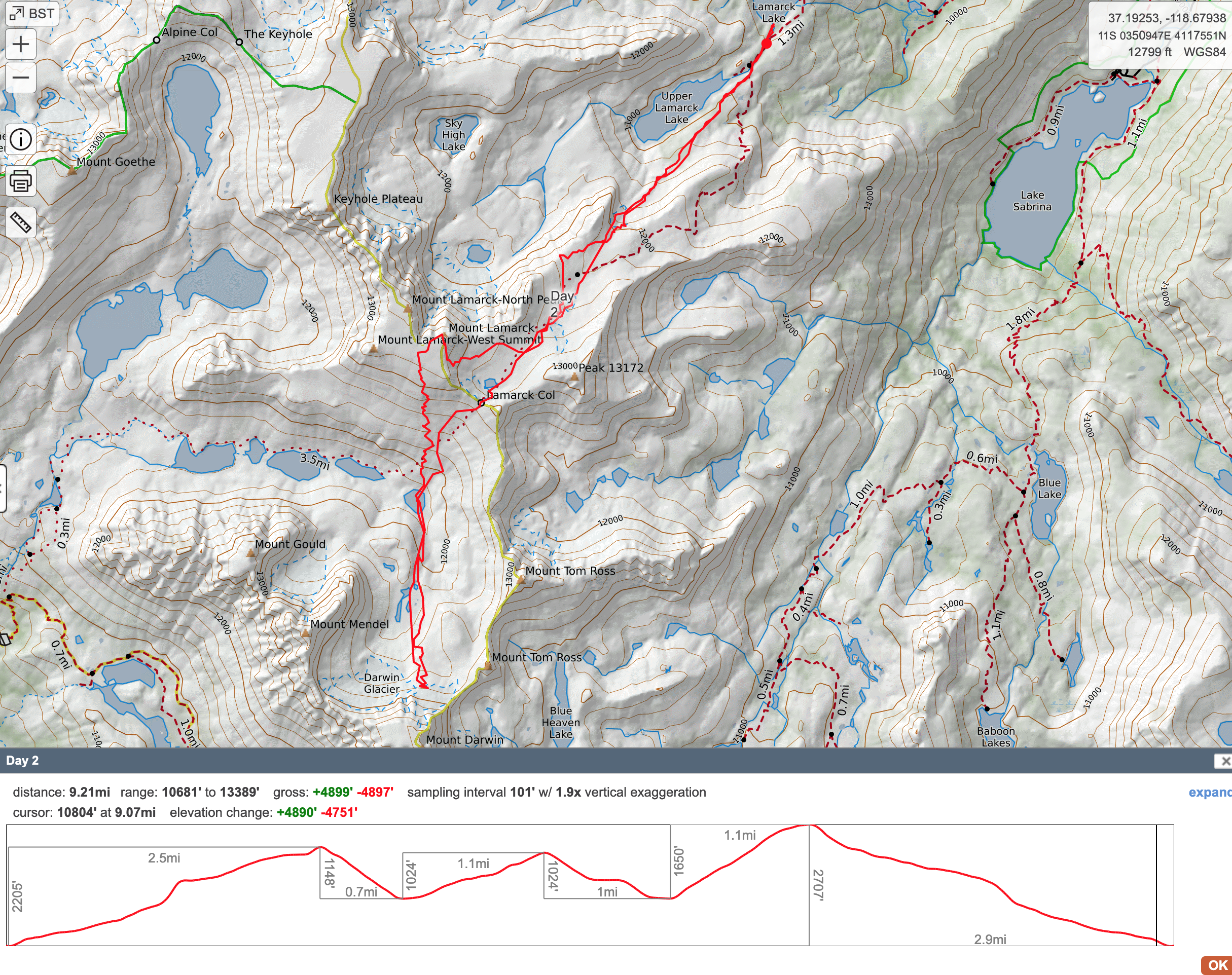
Day 2: Mt Darwin and Mt Lamarck.
This was going to be a long and hard day, so we planned to wake up at 4:30 am and get going. However, if we left too early, conditions could be pretty bad. Therefore, we decided to leave an hour later. Since I didn’t sleep well at night, that extra hour for a late start was great. I got some additional sleep, which is always nice.
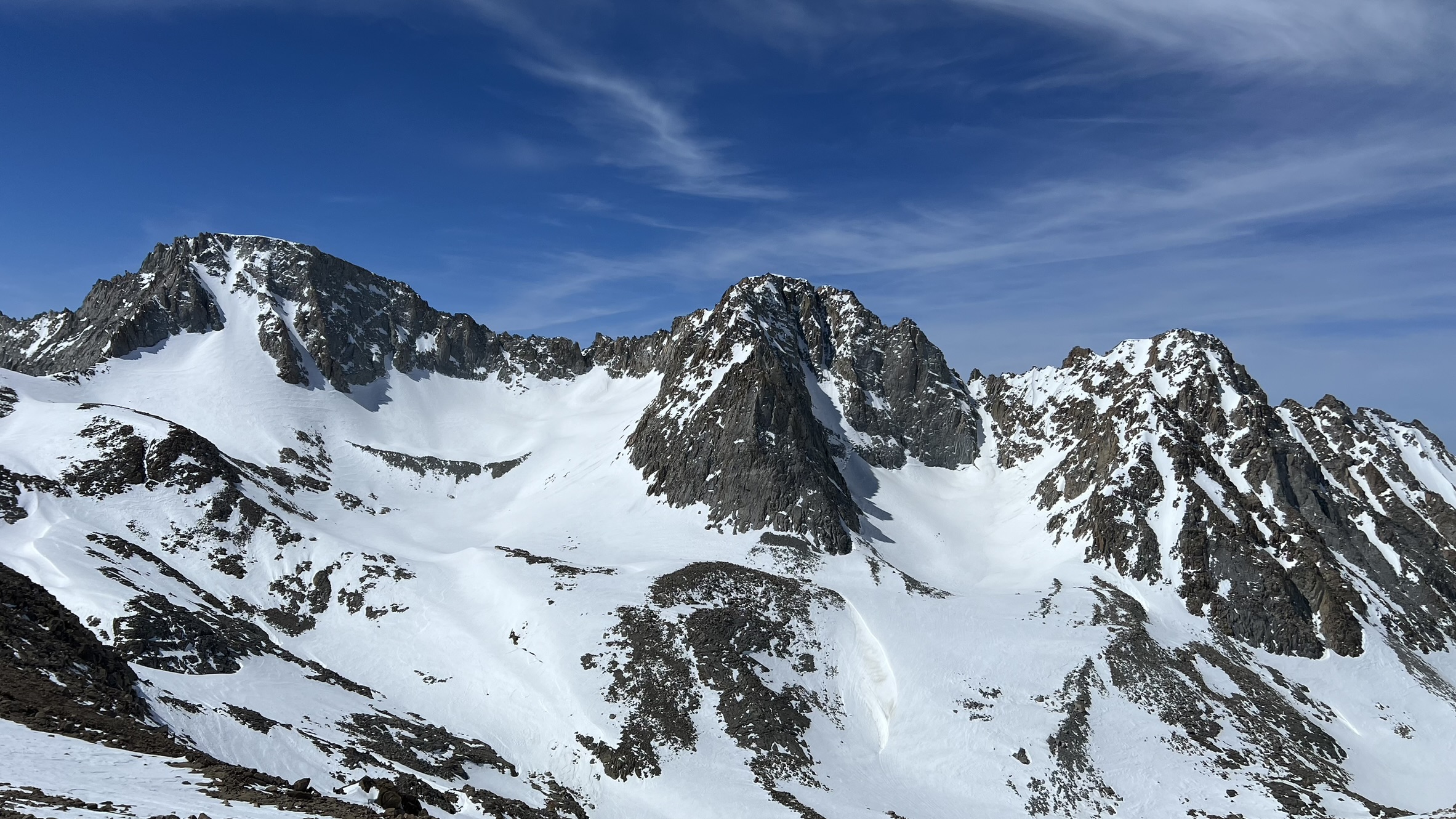
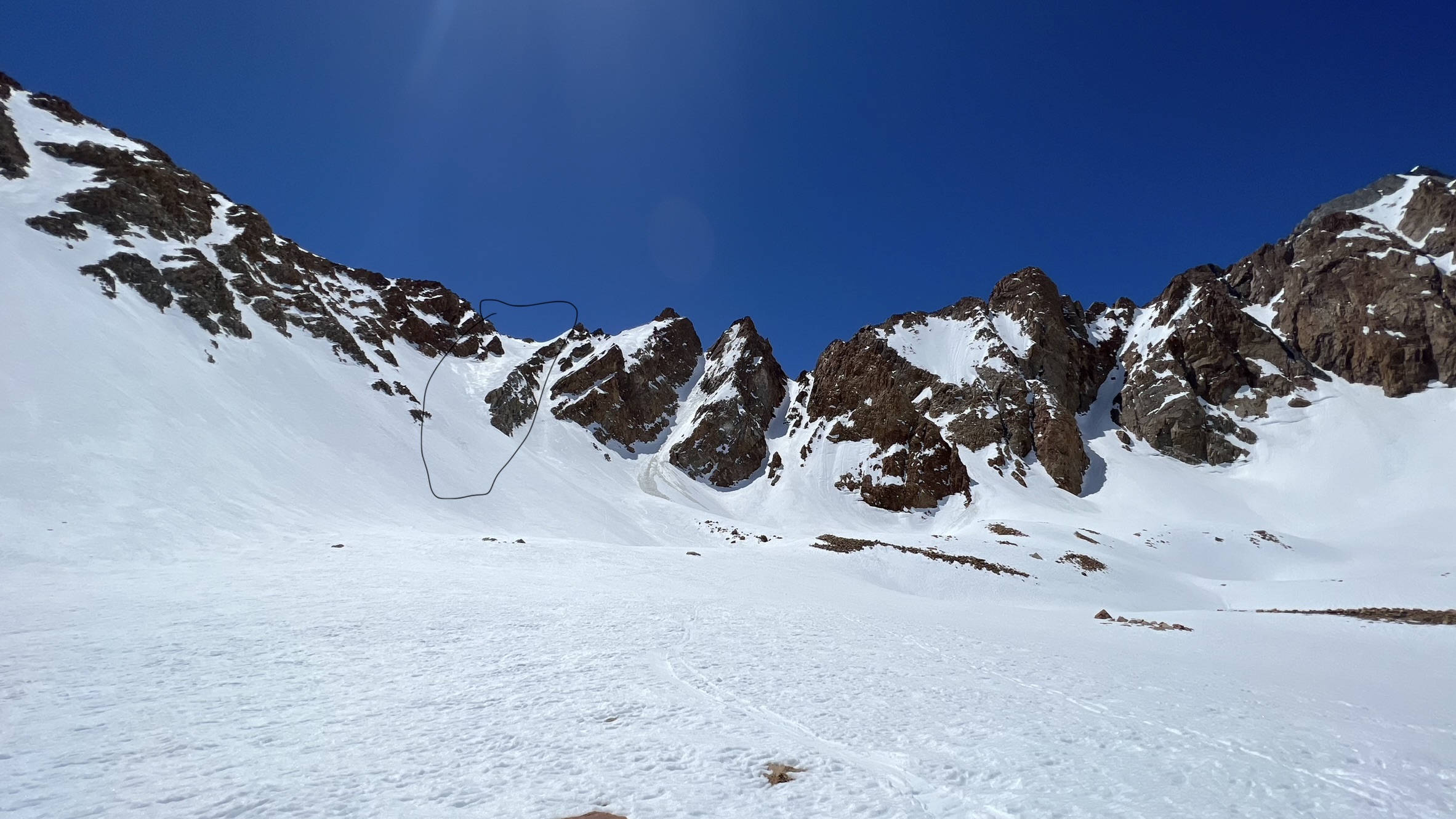
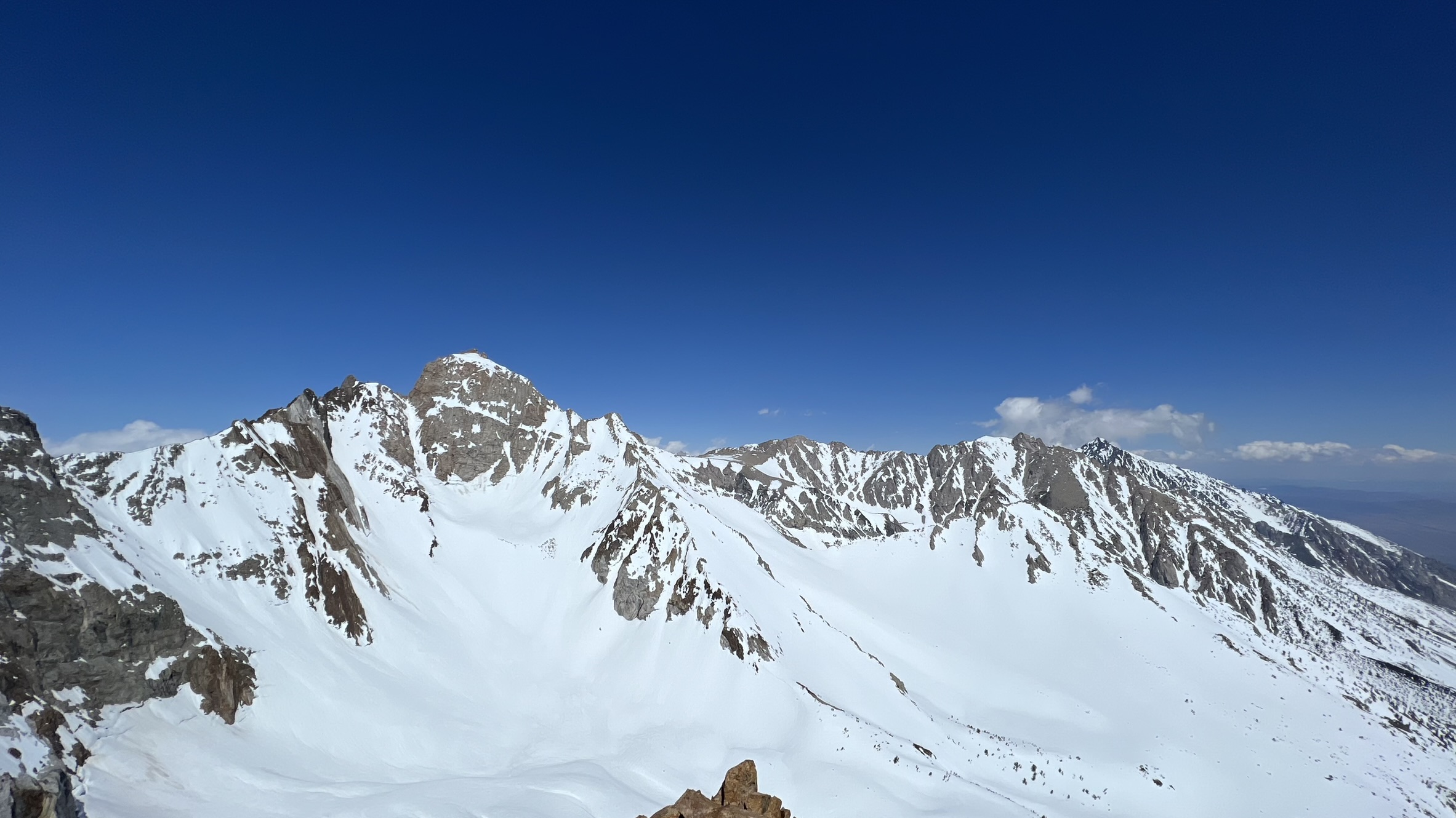
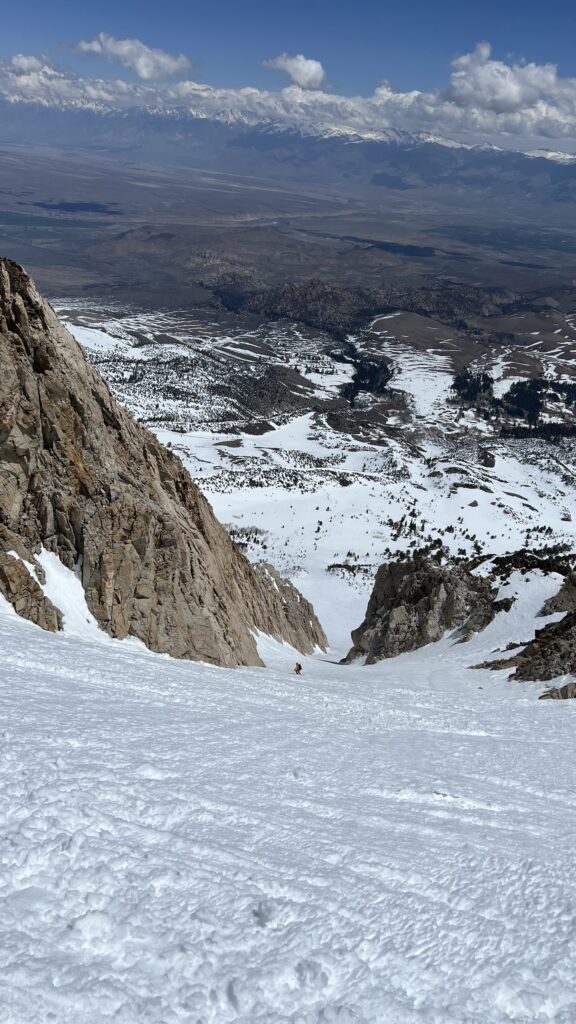
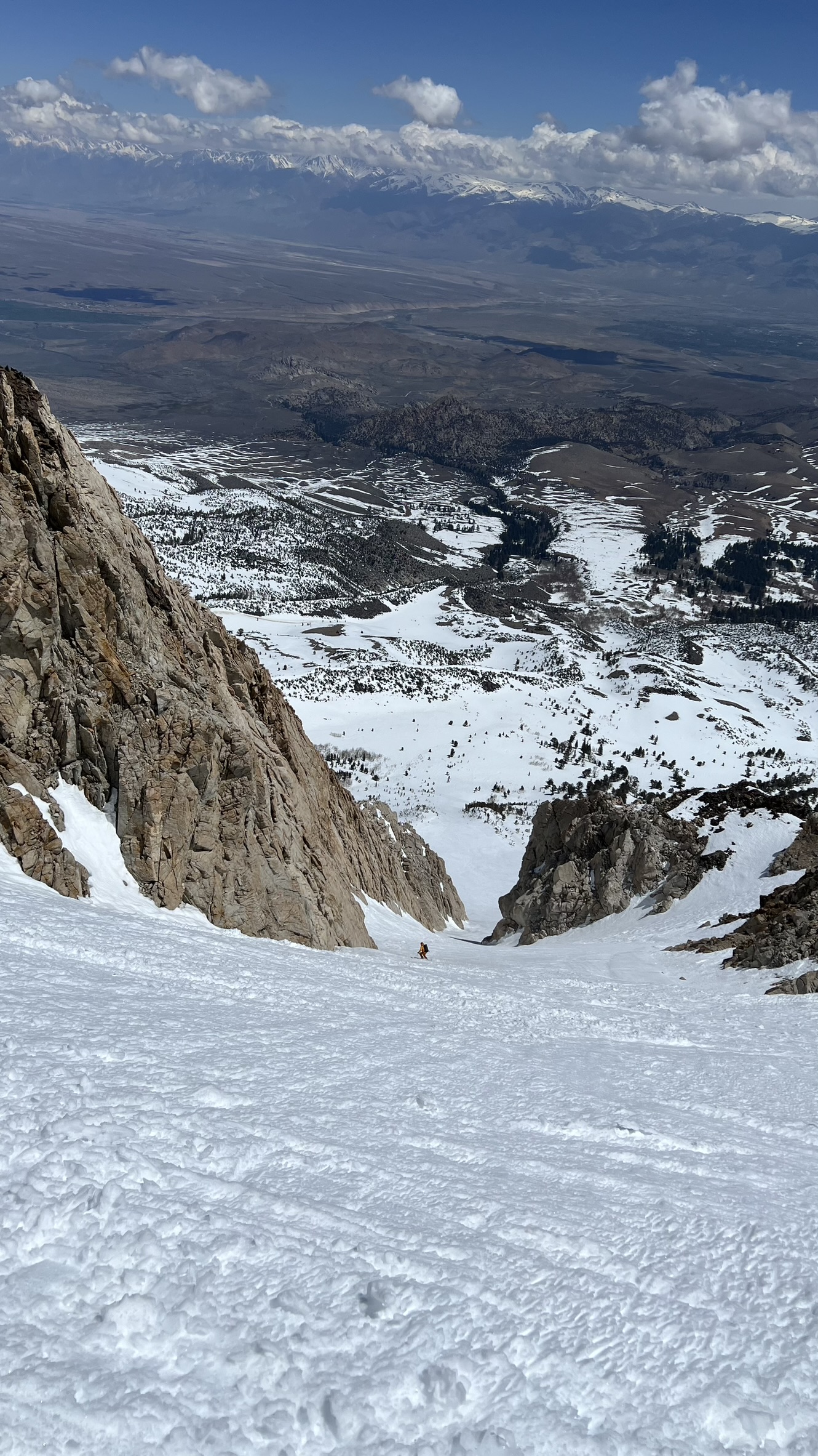
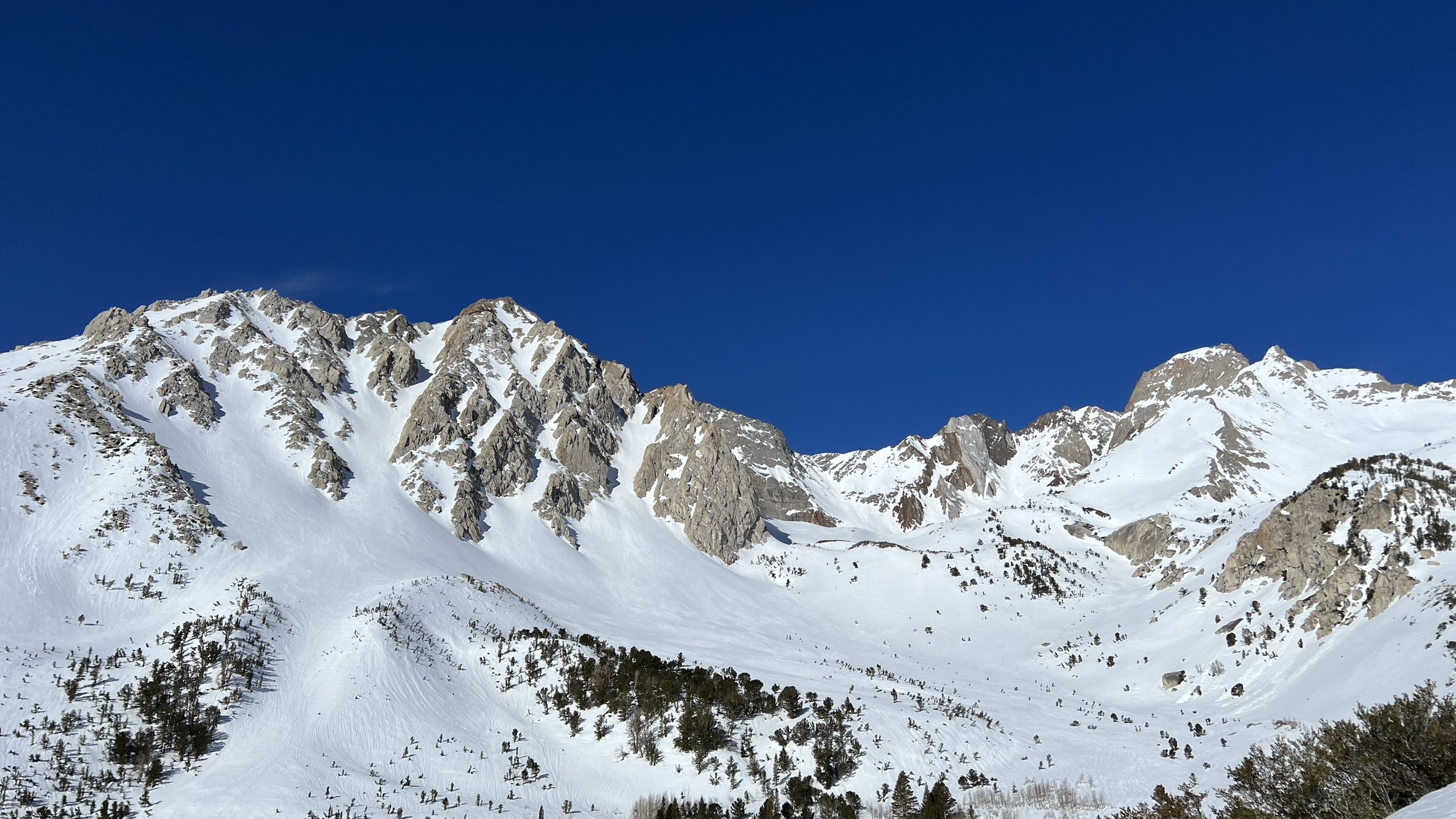
We started around 7 am, and the bootpack we had put in the previous day was solid, which helped us a lot. We reached the top of Lamarck Col at around 10 am. It was our first look at Mt. Darwin, and the North couloir looked intimidating. It was hard to tell if the snow conditions were going to be good or not.
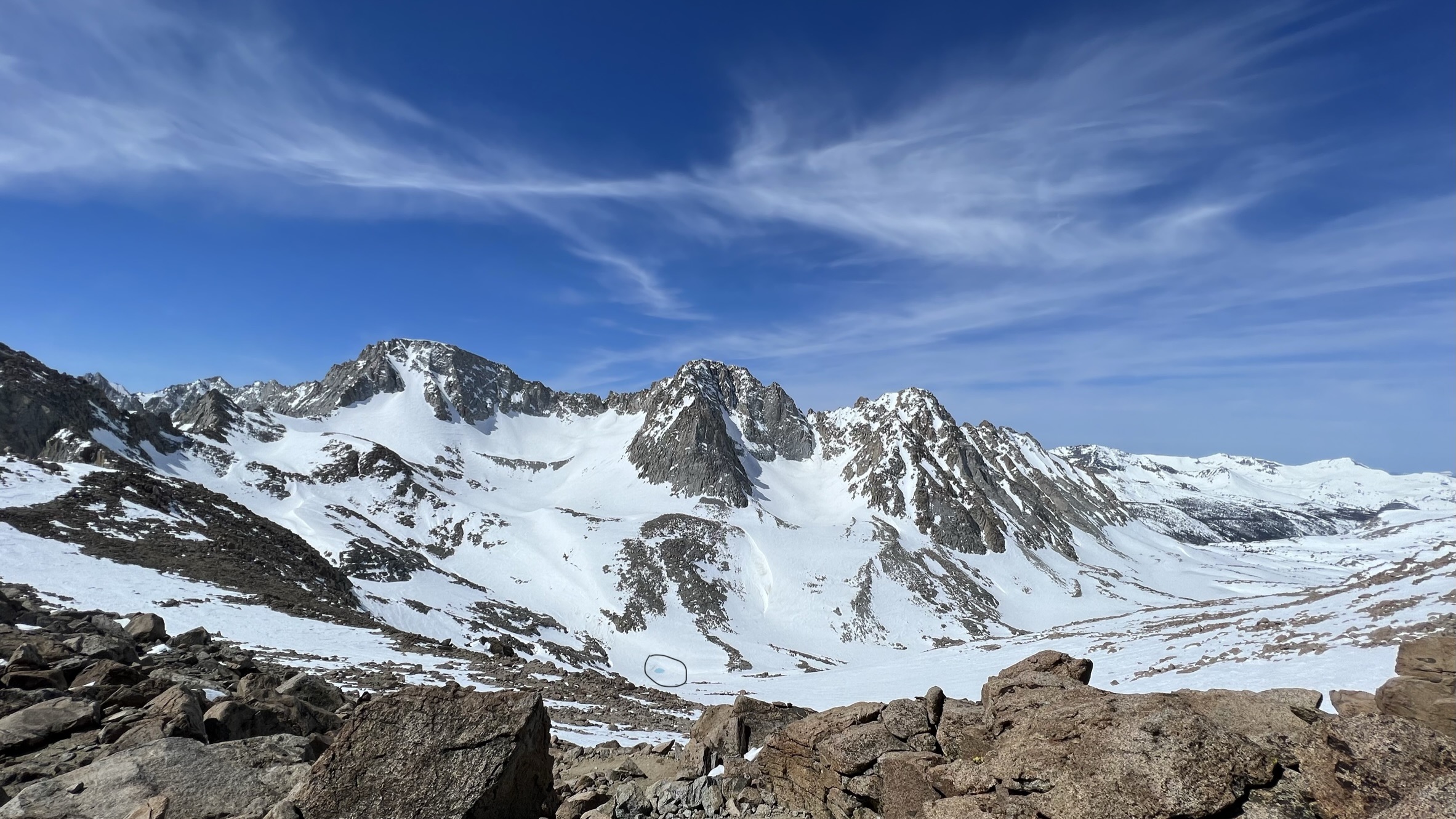
We were planning to ski the the bottom of the slope i.e. the Blue lake highlighted in above picture and then climb to the top of Mt Darwin. The really challenge had just begun and I wasn’t sure if we were moving fast enough to pull it off.
We skied mixed conditions to the bottom of the glacier, and I was glad to drink lots of water and fill our water bottles. We slowly started our march towards Mt Darwin, and as we were getting closer, it seemed like the snow was firm and wind-affected. After our first break, I would have been content with turning around, but since we were already there, we decided to go further and check out the conditions at the base of the couloir. After about half an hour of skinning on firm snow, we decided that it was best to turn back.
The corn cycle hadn’t started high up, and it would be slide-for-life conditions if we decided to go to the very top. With conditions like these, the risk-to-reward ratio is not high, and we were in a pretty remote area, so if something were to happen, it would make things quite difficult for us.
We skied back to the lake and then decided to summit Mt Lamarck and check out its North couloirs to see if the conditions in there were any better. In the afternoon heat, skinning to the top of Mt Lamarck definitely took its toll, and we were quite slow in getting to the summit. The conditions in the main north couloir would have been quite tricky for us to ski, so we decided to ski the south slope off the summit and then check out another couloir a little bit lower.
It wasn’t until 4pm that we started skiing from the summit and now we had to worry about the sun going down and some of the slopes being in shade and getting firmer. We skied some tricky wind affected snow down below and the lower north couloir also didn’t have great conditions. We could have skied down it and made it back to camp but it would have required lot more energy so we decided to ski back down the same path that we came up. We got to camp at around 5.30 pm and didn’t have much time to relax before dinner.
Danny who was going to help with porter duties was there at camp to greet us and he was going to move our stuff to second camp at Birch creek tomorrow. I personally would have liked to reach our camp sooner to get some downtime before dinner, drink lots of water, and relax but unfortunately that wasn’t the case.
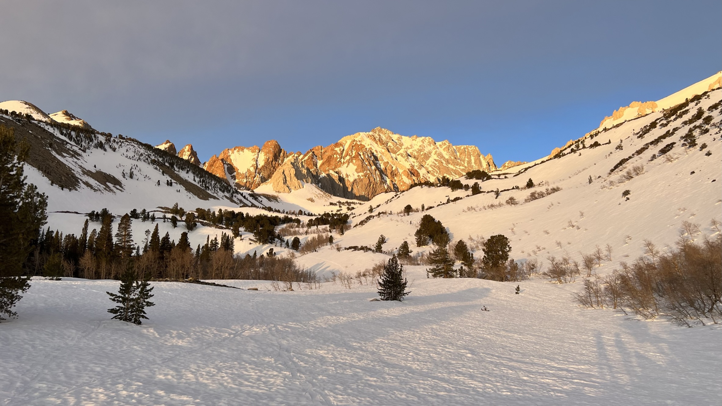
We had some bad weather coming our way, with temperatures dropping and winds picking up. Given the bad weather conditions high up on the north faces and our moving pace, the original plan of Day 3 was no longer feasible, and there was a chance that we might have to cut our trip short as well. I was not happy upon hearing this, but there wasn’t much we could do. I didn’t care as much about not being able to ski the North couloir on Emerson; my main goal was being able to ski Mt Tom, and it looked highly unlikely.
Day 3:
Today’s plan was to break camp and let Danny move our camp to Birch Creek while we would go with our day packs to North Lake and try to ski Paiute Crags or Bishop Bowl over to Birch Creek.
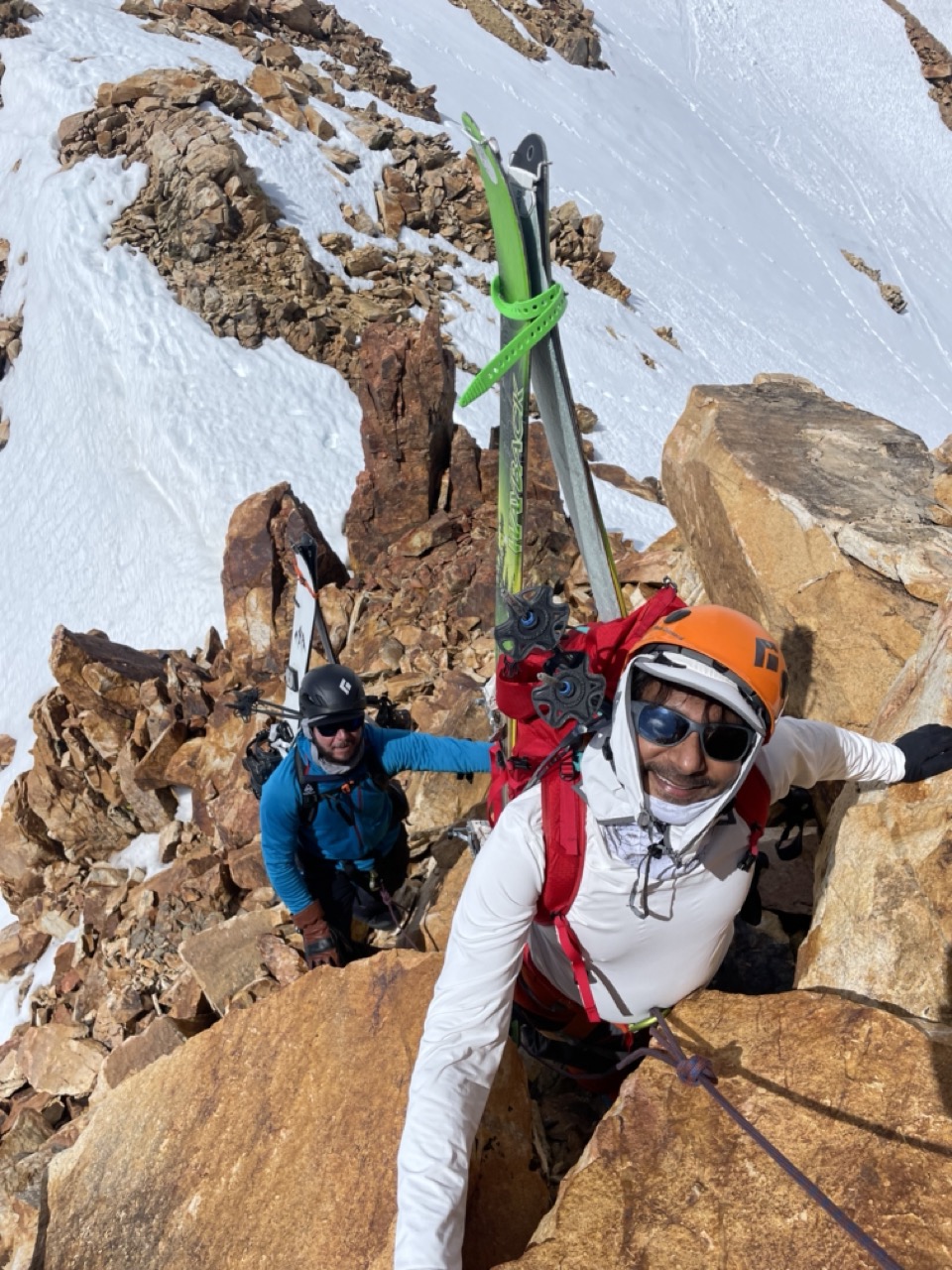
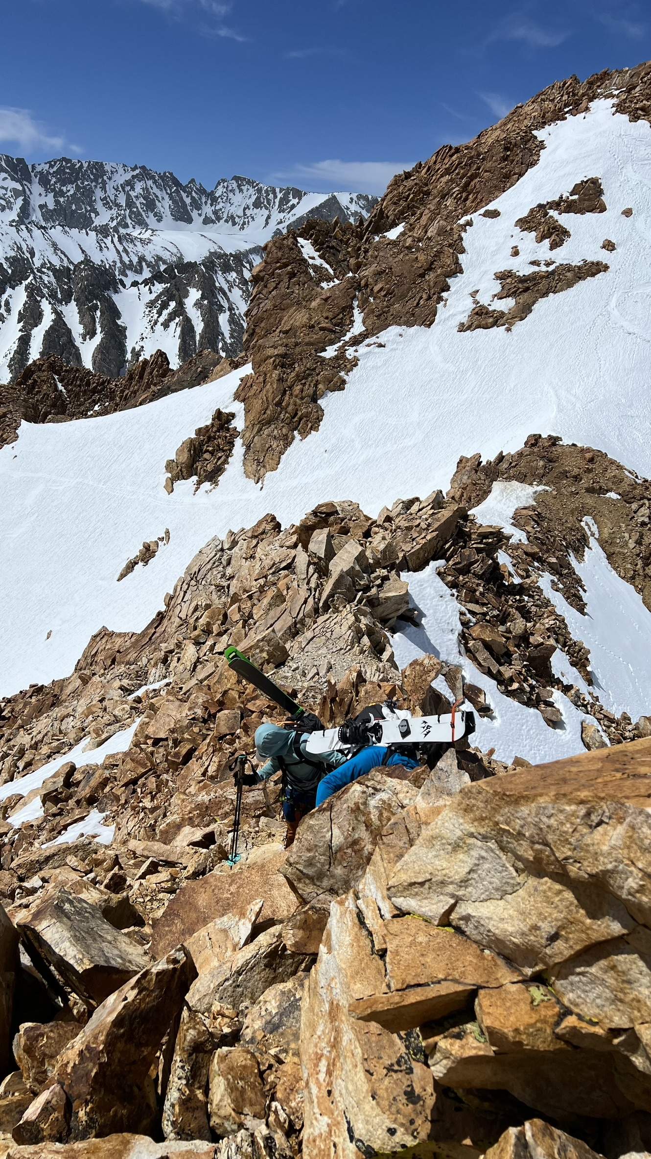
The ski down to North Lake was painful, with the Northeast face frozen solid, and our quads got a good massage getting there. We identified a south-facing couloir that would be fun to climb up and ski down, but it also meant that we would have to climb it for the second time to get over Paiute Crag and reach Birch Creek, or go around via Bishop Bowl, which would be a slog as well.
We decided to go over the crags only once and ski down to Birch Creek. There were steep sections where we switched to crampons, but my preference was to skin, so I asked Howie if I could do that. The final section was steeper, and we decided to rope up for it, leaving me no option but to crampon up the slope. I am not really a fan of short roping, but I knew it would only be for a short while and didn’t really have much choice, so I went with it. It took us about 3 hours to get to the top of the ridge.
We were not able to ski from the point where we topped out so had to do a little bit of a rocky traverse which would get us to a place from where we could ski down to Birch creek. One small section was little tricky so we roped up again.
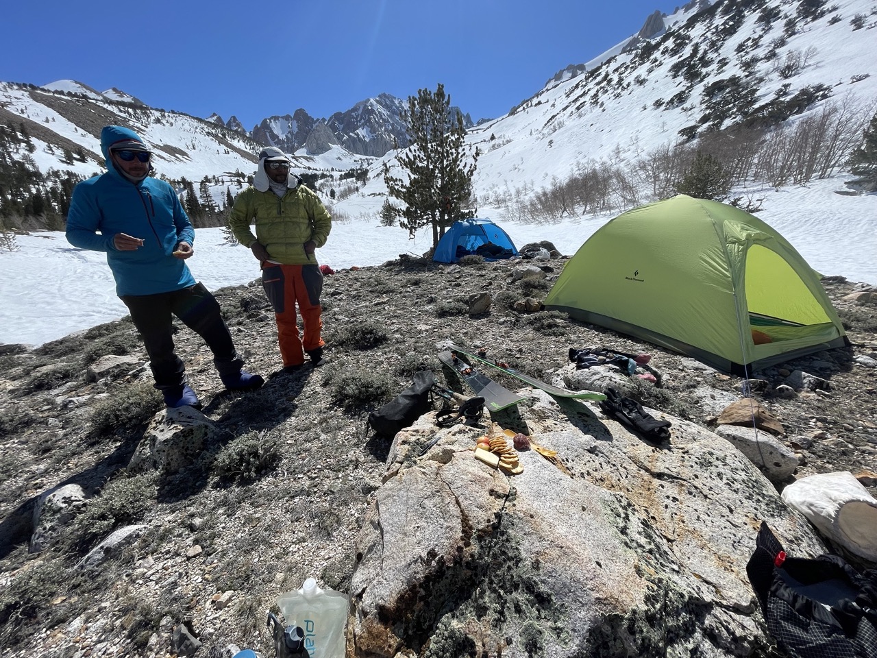
The slope was in good condition for skiing and we were able to find good skiing conditions all the way to the camp but where was the camp? We were supposed to be on the lookout for our tent pitched at around 9800 feet but there wasn’t any sign of it. There was some miscommunication between Howie and Danny about the location of our campsite but luckily we had cell phone coverage and Howie was able to get in touch with Danny regarding the spot where he put in our camp.
Since we were going to get some winds, we wanted to put our camp at little lower elevation and we had found a really good dry spot so Howie decided to move it from the original spot that Danny had picked. This spot didn’t offer us any flowing water so we would have to melt it all for our needs but it wasn’t a huge deal.
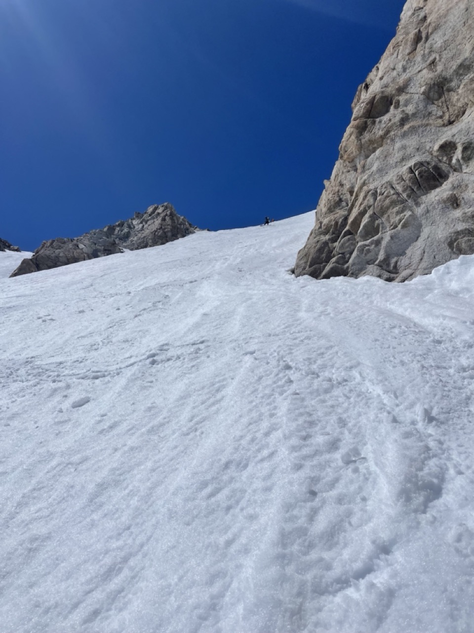
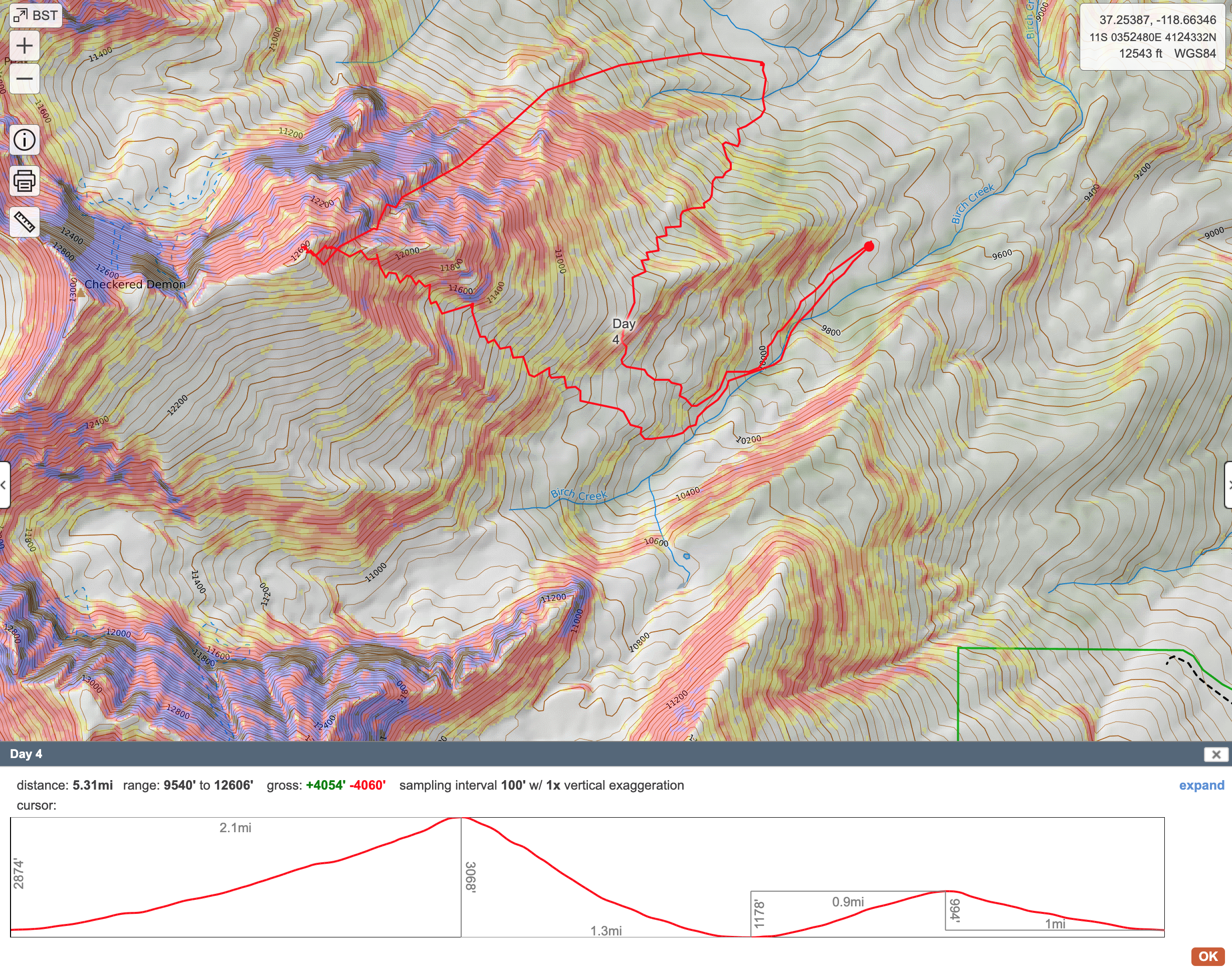
Day 4:
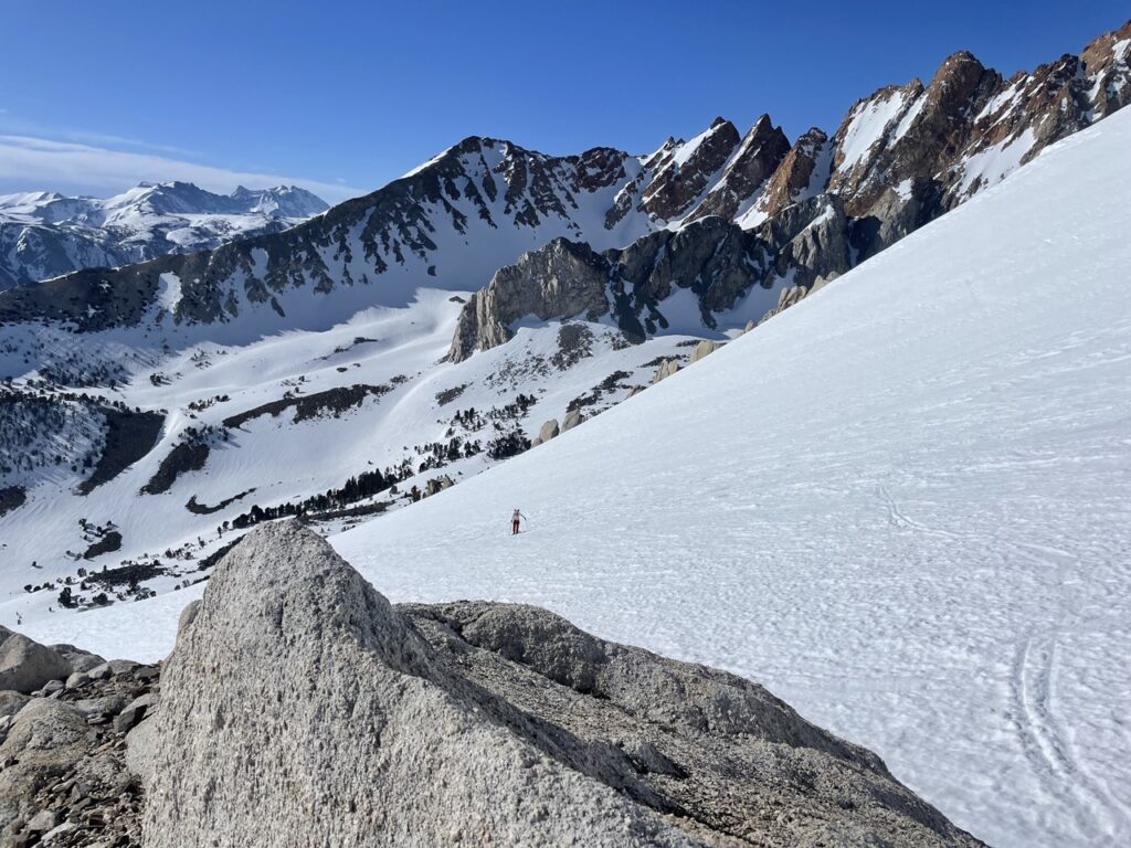
It got super windy at night and I was worried that this day would be a dud and we won’t be able to get much skiing in. Fortunately, we woke up to mostly clear skies and no winds. The initial plan was to go check out the North couloir of Emerson but chances were that the snow in there would be quite firm and wind affected in it so we decided to head over to Mt Locke and ski the central Wahoo gully.
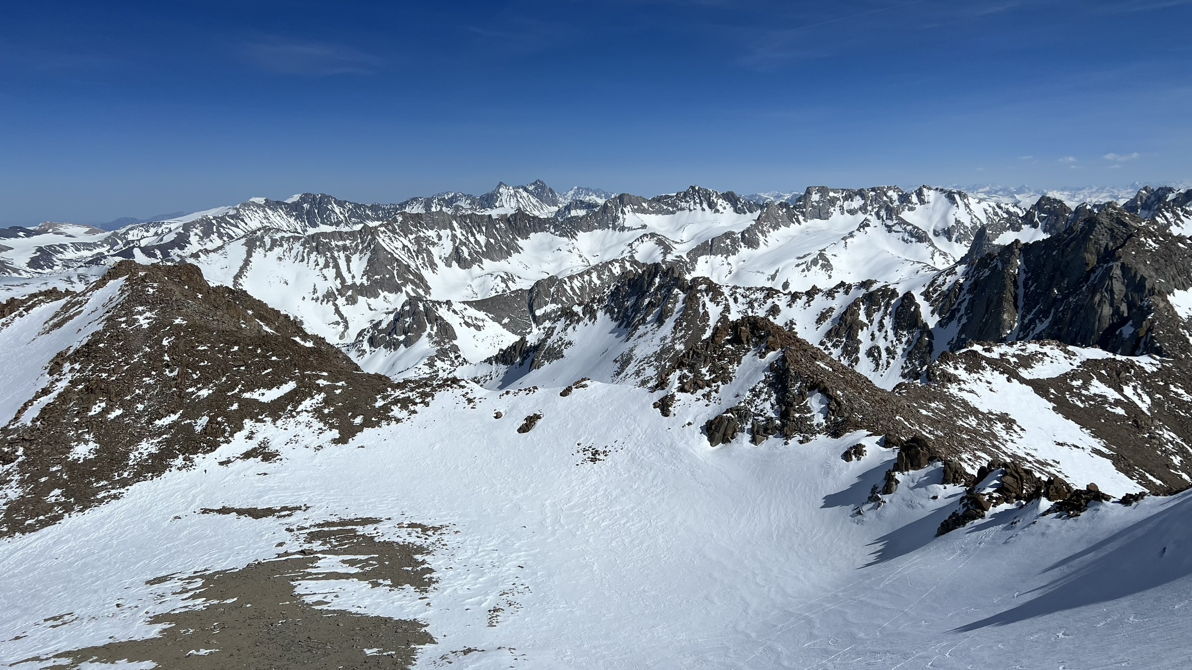
It was slow going for me initially, and I was falling behind. But after the first rest, I was able to get my breathing under control and make the slow march towards the summit of Mt Locke. For the final slope, we decided to switch to crampons, and I was glad that we didn’t rope up this time. Surprisingly, there was good cell phone coverage at the top, and I was able to make a Facetime call to my wife and show her the amazing views from the summit.
Falling Behind 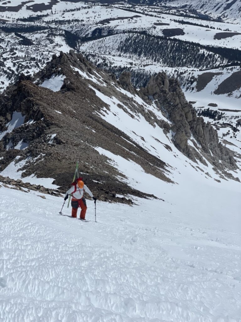
Booting up Final slope 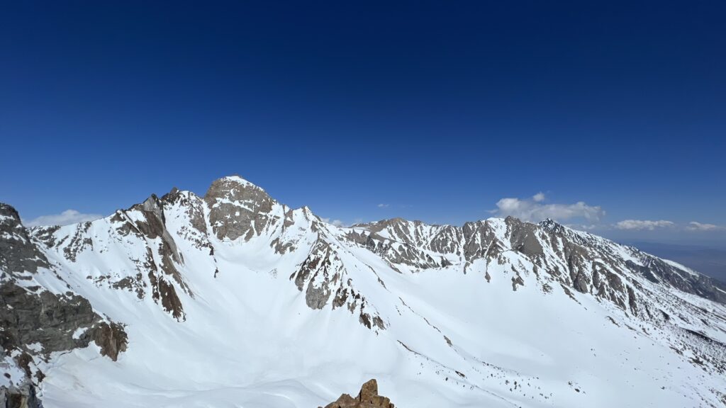
Summit Views
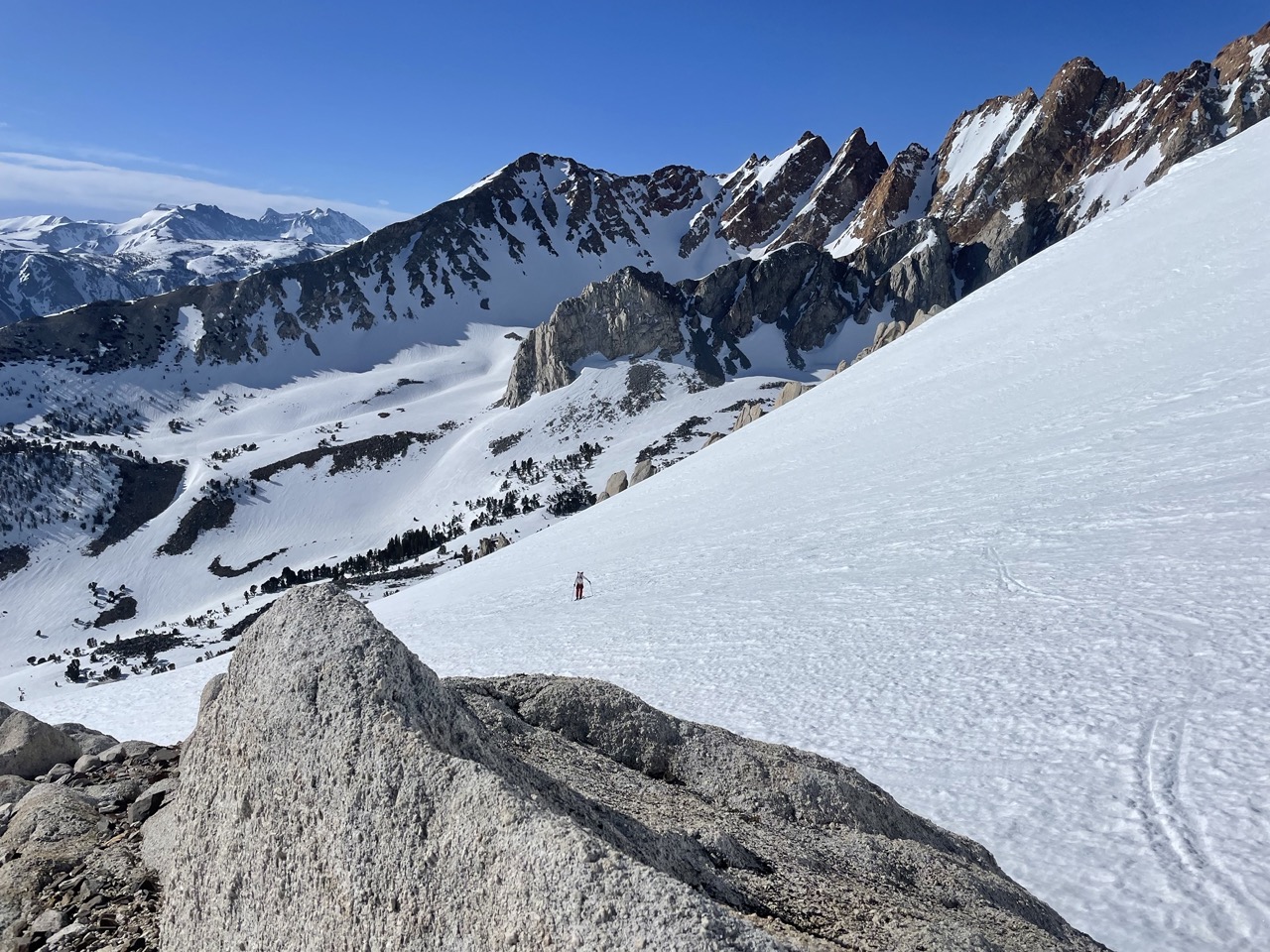

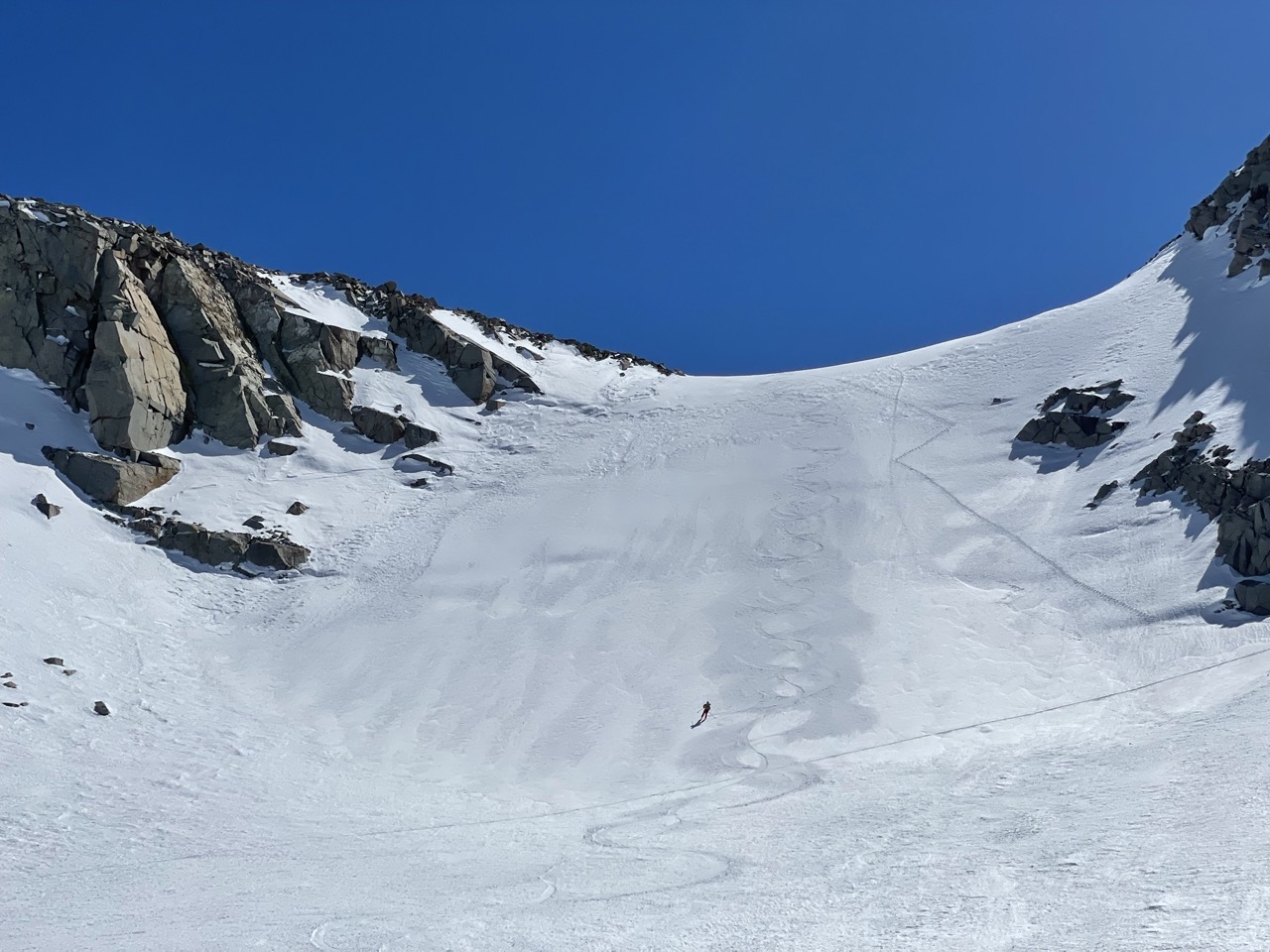
The wind was picking up at the summit, and it was time for us to descend. Driving up along the 395, you can see the main Wahoo gully. Prior to this trip, I was wondering about its steepness and how terrifying it could be to descend into it, but in reality, it wasn’t that bad. I always get nervous about steep slopes, but if I am following someone like Howie, it really helps. In the end, it seems like I make a big deal out of it.
Looking Down the main Gully 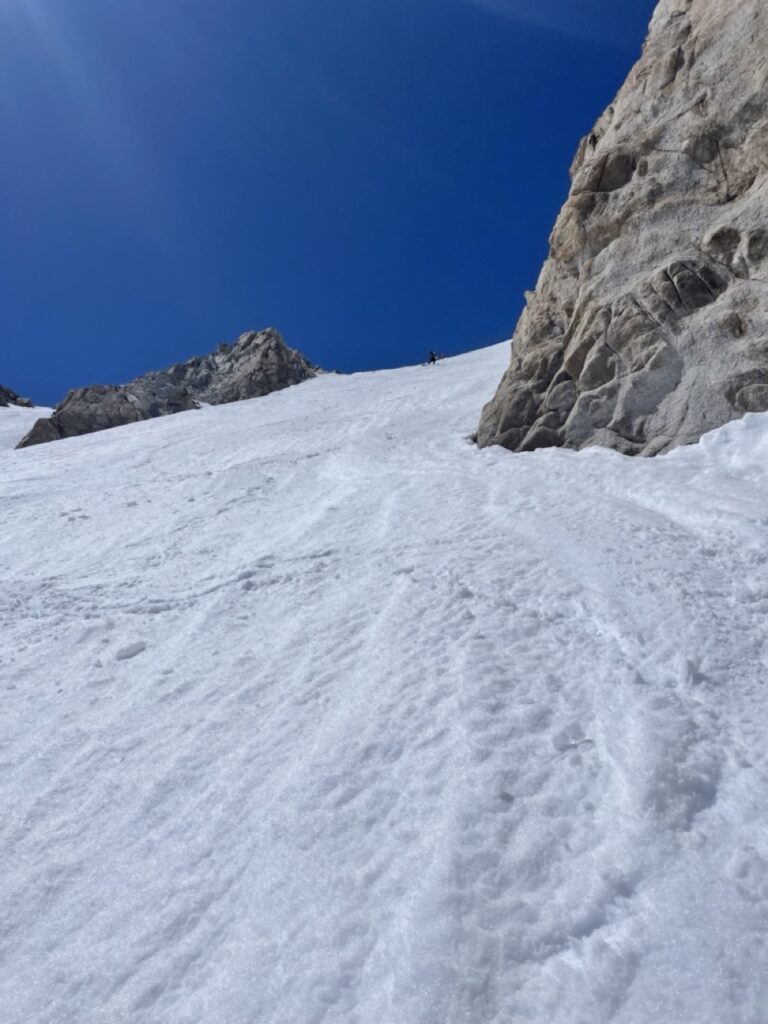
Looking up from Middle. 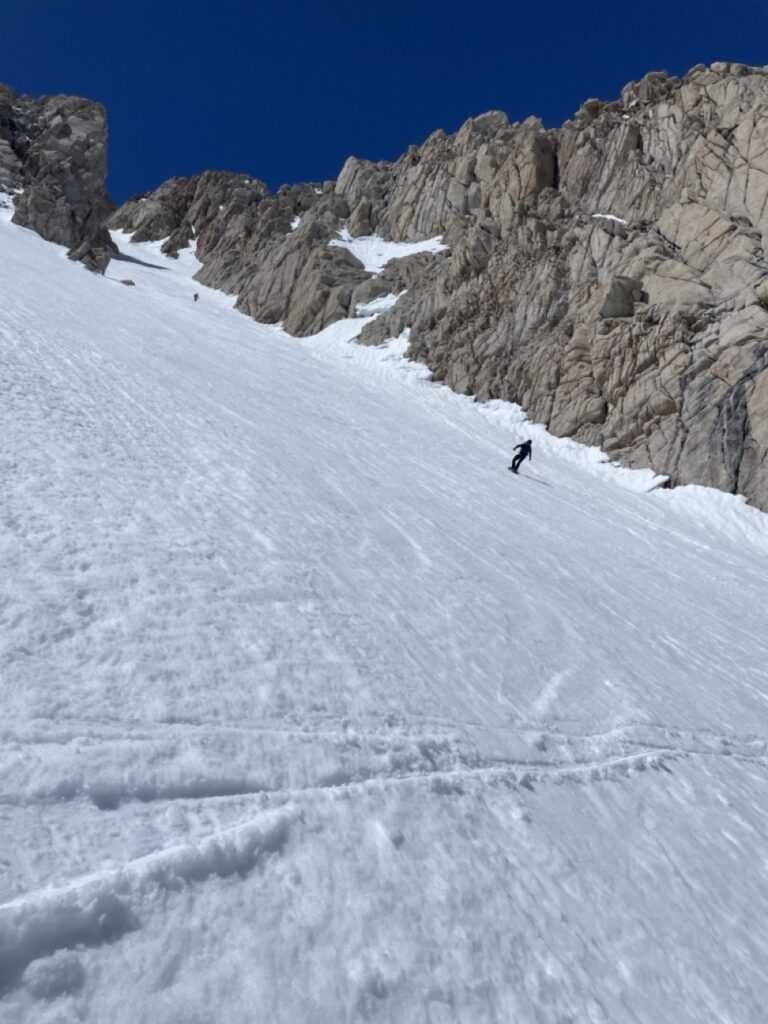
Almost at the end.
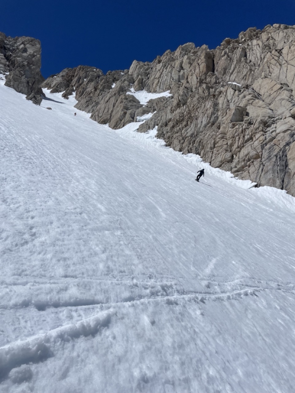
It was a nice, long, fun corn run, and we milked it for as long as we could. I thought that to get back to camp, we would simply cross over a ridge and ski down to it, but nothing is easy on this tour. We ascended almost 1200 ft to reach the other side of the slope and then ski down to the camp. I was feeling pretty good and could have gone even higher for some additional turns, but I decided not to since it was getting late in the day. It felt really good to ski one of the classic lines in the Bishop area.
With the weather forecast not improving, we made the call to end the tour early and informed Mike (our shuttle pickup) about it. As we arrived at the camp, the winds were starting to pick up, and after dinner, they grew even stronger once we returned to our tents for the night. I was a little worried about breaking camp and packing everything up in this windy weather, but my fears were unfounded.
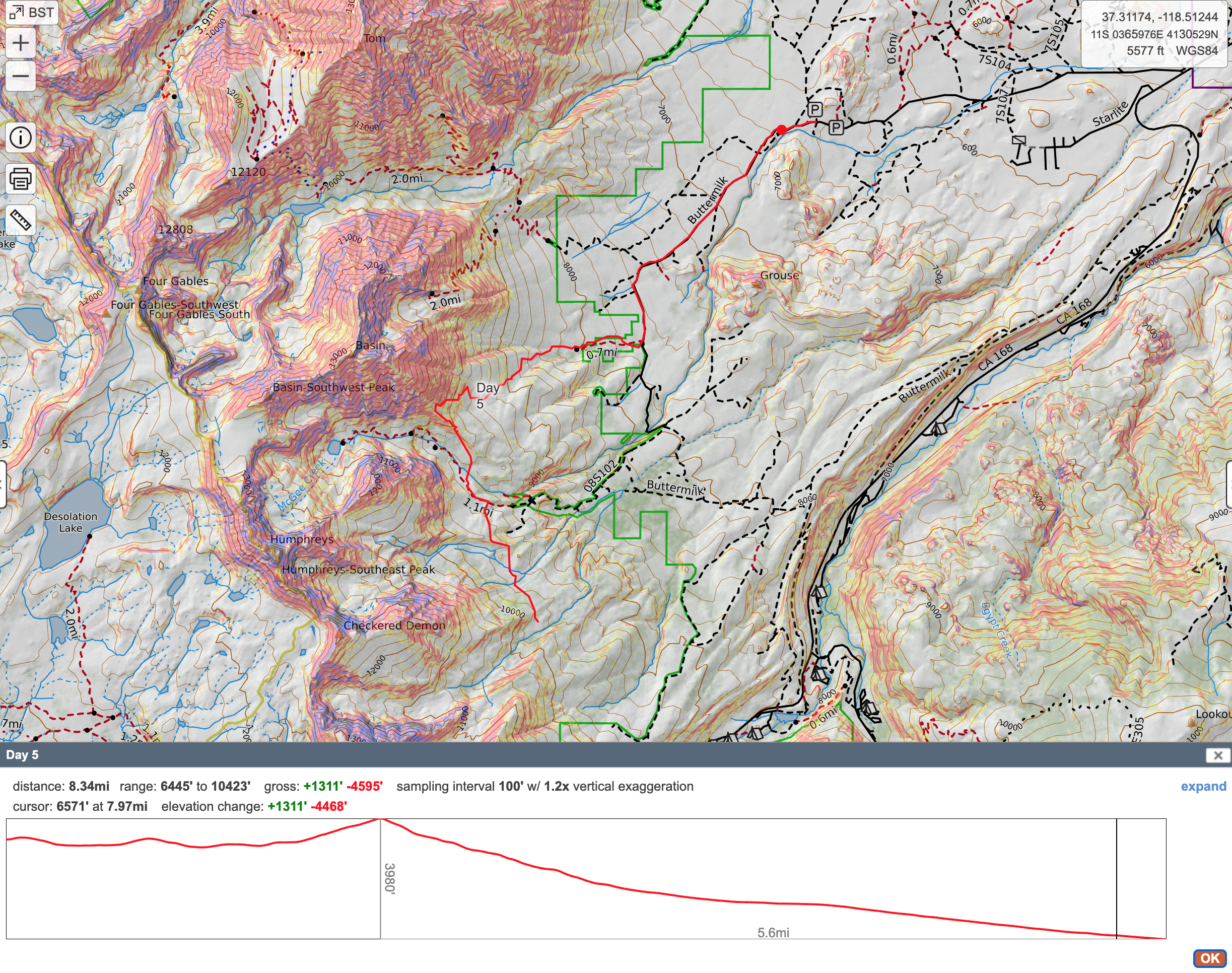
Day 5:
Thankfully, My fears from last night didn’t come true and the winds died down in the morning which allowed us to break camp without any hassles. Our exit point was towards buttermilks road so we were going to try to get little higher and ski out all the way to the desert floor.
We had a make a few transitions to get to a high point on Basin mountain for our ski descent, the final skin up one of the ridges was particularly tricky due to hard snow.
As we got to our high point, the clouds had rolled in and the winds picked up so there was no point in even trying to go any higher and we started our long fun descend all the way to sage brush.
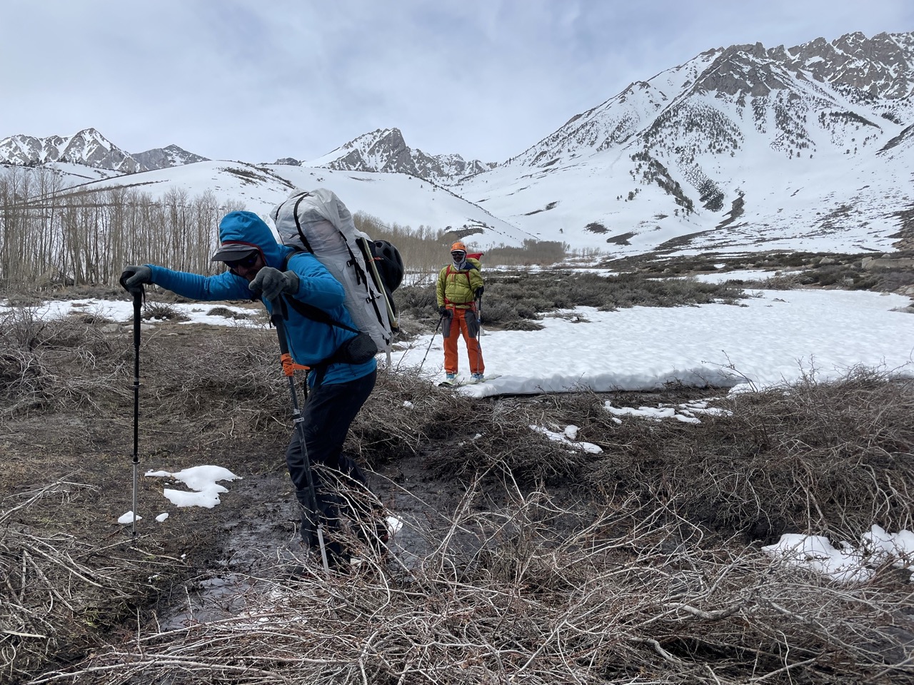
We connected the patches of snow all the way to the Buttermilks road where Mike was going to meet us but the road had washed our and he couldn’t drive to meet us so we had to hike a few extra miles to meet him. The road was in pretty bad condition and we saw a car stuck and the rescue car also got stuck so there was a third car on way to help them out.
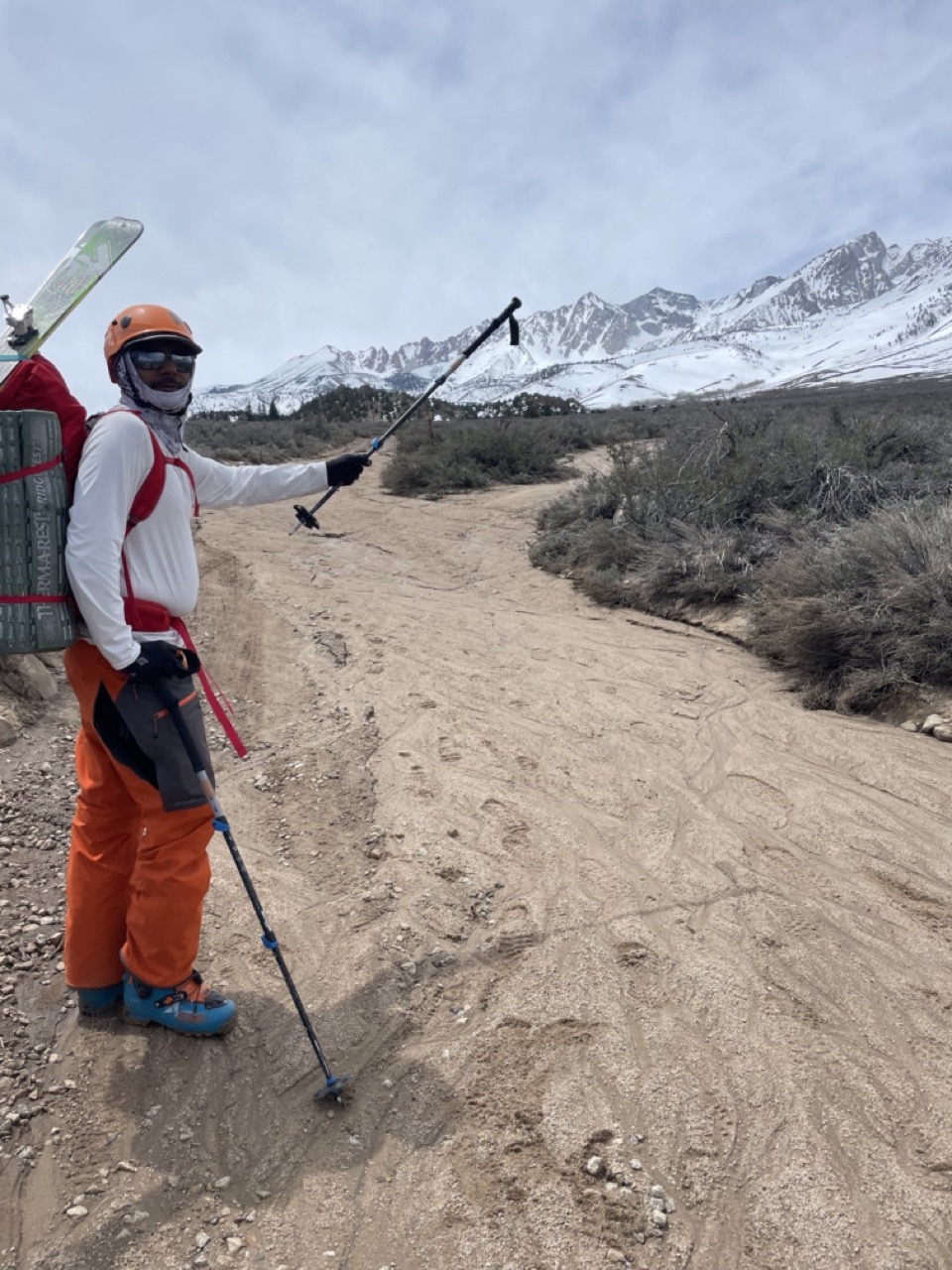
Mike had some cold brews for us, which felt great. After a trip to the SMG office to sort out gear, we headed to Bishop Brewery for a nice lunch.
Overall, even though we didn’t complete the tour as intended, it was a great experience, and I am glad that I attempted it. Over five days, we ascended and skied over 17k feet, traveling over 37 miles, which is not bad at all. This tour reinvigorated me and has motivated me to get in even better shape, along with working on my steep skiing technique.